The two companies have very kindly supported us with their navigation products to help us complete our trip safely and in the shortest time possible.
Neptune Navigation (see http://www.neptune-navigation.com/) have loaned us a copy of their software and the appropriate maps in order to plan the route. The software comes with built in tidal data so allows us to plan the best date and time to set off. It will also let us see how long the trip is likely to take us if we slip below our target minimum speed of 2mph (over 12hours!!).
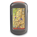
 The other sponsor helping us to safely complete the crossing is Garmin. Anthony Chmarney of Garmin has kindly loaned us one of their Oregon 450 handheld GPS devices. This will be invaluable on the trip as it will help us ensure we are following our planned route and not drifting off course with the tide.
So no excuses for getting lost!

